
In a previous chapter I mentioned a few things that have changed in Greenland over the 16 years we’ve been voyaging up here: less ice, more English, more sailboats, earlier cruising season, and a busier capital city due to oil exploration.
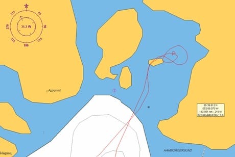
Onboard Morgan’s Cloud one of the biggest changes is that we now have electronic charting for the first time while voyaging in Greenland. And so far we have been able to navigate electronically, because C-Map has done an amazingly good job of correcting the datums (the original paper charts are off by as much as ½ mile in places against the GPS).
However, there are still some spots where the datums are significantly off and we suspect that this discrepancy will only increase as we continue north. Since we have all the paper charts we aren’t worried, though we are a bit concerned about how rusty our ability to use the hand-bearing compass, parallel ruler and course protractor has become!
What is worrying is how seductive electronic charting is: after using a plotter for just a little while it is extremely hard to believe that the picture on the computer screen is not reality! So we are constantly reminding each other that we have to regularly confirm our position relative to the land using radar ranges and bearings, which are reality.

Another thing to watch as we move north, is that the autopilot is getting more and more sluggish, particularly on north headings, due to compass dip (the compass card dips toward the magnetic pole), suggesting we will need to hand steer in tight passages before too long. Which is one reason why it is a good idea to take extra crew along for these trips; not to mention the fact that the daytime “high” on the water has been around 4-7°C (35-38°F), making standing watches in an open cockpit a chilly job with frequent relief welcome.
We are presently snugged up in a sheltered island anchorage at 65°40’ N, 53°09’ W, near a deserted Greenlandic community that we are hoping to hike to this afternoon. Once again fog lurks outside the anchorage but, so far, we are in sunshine. We are also in mosquitoe-land—bug shirts will be de rigueur outside from now on. Greenland mosquitoes are big and slow and easy to swat, but there are so many of them that they get the job done anyway!
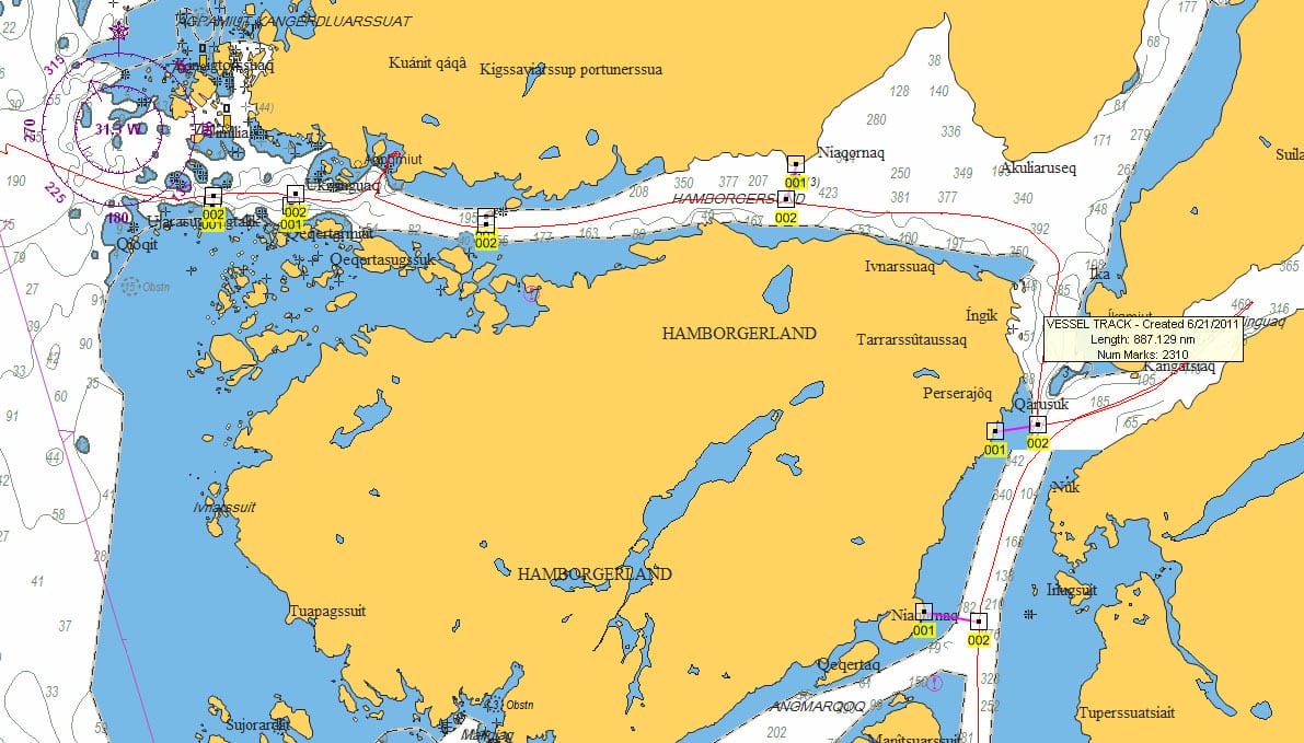
I use C-Map and don’t intend to change, but one does not have to be in the boonies to have problems with their data. Between Annapolis and Ft Pierce we have chart tracks that take us through marina docks, bridge piers and abutments, and significant amounts of 15 cm deep marsh. Perhaps the worst was the bridge that is shown exactly as NOS shows it, but NOS has it wrong by 300 meters because they used the “as approved” drawings to put the bridge on the the chart rather than the “as built.” C-Map copied them perfectly.
You may want to look at adding a rate gyro (gyro compass) to your AP control loop at some point. They are not terribly expensive (~$800) and not only take care of dip issues but can prevent “the toolbox got to close to the sensing compass” issues.
Hi,
Amazing trip and site you have!
Regarding the problem with compass in high latitudes, I just came from the Ross Sea, at 78 degrees 39 minutes South, and one thing that can help is the use of a satellite compass like the ones Furuno produces, the SC 50, for example. We had those on the ships and also on the smaller boat, a 110 ft trimaran, and the autopilot worked perfectly with them. They are a cheaper alternative to a gyro compass and attainable for boats in the range of Morgan`s Cloud.
Cheers
Hi Luis,
Thanks for the suggestion. I think these units are a great idea and we intend to look at one in the future. As it transpired our Simrad autopilot fluxgate worked fairly well, albeit a bit sluggishly on north headings, up to just shy of 74 north and over 40 degrees of variation.