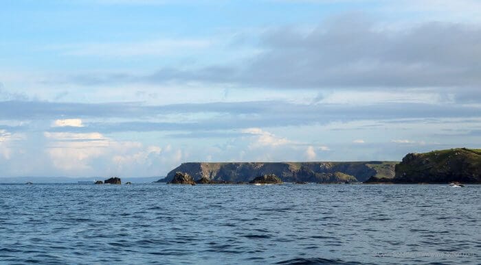
Sailors visiting our home waters around the western shores of the British Isles and Northern France are often astonished at the powerful effects that our strong tidal streams have on passagemaking.
With a tidal range of up to 15 m (50′) in the Bristol Channel, and the Bay of St Malo close behind at up to 13 m (42′), that’s perhaps not surprising. If you sail (or plan to) in the world record Bay of Fundy with its up to 16 m (52′) range, or the Inside Passage between British Columbia and Alaska on the west coast of North America, then you’ll know that this is relevant to you, too.
A Tough Example
To make this interesting and relevant, join me, in this five part series, on a late April passage through the Irish Sea, from Falmouth in Cornwall to Oban in Scotland (c. 450 nm), a voyage I have made dozens of times in a variety of ways, from day sailing all the way to non-stop.
On this passage, easy to enter all-access ports, especially those able to accommodate larger (> 12 m/39′) yachts, are few and far between. On the positive side, there is an area of relatively slack tide in the middle sector of the passage, which can allow you to relax a little.
In the northern sector of the Irish Sea the tidal streams pick up once more to become stronger with each additional mile, leading to a major tidal gate in the North Channel between Scotland and Northern Ireland. Once through that gate it’s back to working the tides once more, dealing with some strong tidal streams and associated races before arriving at Oban, our final destination.
In summary, a passage that demands a good boat with a capable crew who possess flexibility and gumption in equal measure. And two passages are seldom alike due to the vagaries of wind and weather. Challenging it may be, but potentially rewarding, too.
Let’s start with my tips for planning this, and other, coastal passages:


Hi Colin,
Nicely done. That part of the world certainly has many major challenges all closely packed in a relatively small area. I was talking a few years back with a global circumnavigator, recently returned and UK based, and we decided that anyone successfully navigating a UK circumnavigation could go most anywhere.
Coastal passages are a particular challenge because they are passages, and all the challenges that passages can present, as well as your vessel being near the hard stuff- land- and all the other vessels that seem to proliferate along the coast (not to mention the “growing” hard stuff like wind farms, aqua-culture, large ships anchorages that also reside in “open” water).
But, being near land does allow for what I call “bail-outs”, something not possible on ocean passages. To this end, one addition I attend to in the planning part of a coastal passage such as you describe is to prepare a list of “bail-out” harbors/ports along the way. These can be anchorages or towns/cities where help might be possible and I attempt to look for those where entrance is all-weather (or most). It is help that may be of most interest in these days of pretty reliable weather prediction, so I concentrate on those places where there may be a maritime presence to deal with breakdowns etc.
I do this ahead of time, in part as it gets me in sync with the trip, but also because I would try to get paper charts (or good guide book descriptions/representations) for the harbors of interest. Bad luck in this area might be a lightning strike which might compromise not only nav aids, but also all comm for calling for help in getting into ports. A chart and good dead-reckoning is likely to get you to the entrance buoy of most large harbors safely.
My best, Dick Stevenson, s/v Alchemy, on day-hops along the Nova Scotia coast line.
Hi Dick
this is indeed a voyage with the power to instruct – with relevance to many other areas I know you have visited, too. Like you we always carry passage charts and local pilot books as well as (for this area) the excellent Reed’s Nautical Almanac, so that we have a viable ‘get you in safe’ option if our electronics should fail.
I’ll be looking at ‘Plan B’ ports and how and when to use them to the best advantage to make this a safe and swift passage – vital at all times, and look forward to your valuable contribution as the next sections appear.
Best wishes
Colin
Dear Dick
I second your comment that if you can navigate British coastal waters you can probably sail the world. My stock answer to the question “how scary is it to cross an ocean” has always been that the Dover Straits is the scariest place I’ve ever been. No word of a lie.
Now that I am reduced to messing around sailing coastally my eyes have been opened to a whole new world of passage planning. Before I used to plough up the middle of whichever channel I was transiting and get the journey over as quickly as possible. Now I plan intricately.
But I still manage to trip myself up. Last summer I decided to have a go at the inside passage of the Portland race. A passage that as a sensible ocean sailor I had always given a wide berth to. An exciting experience and if you get your timings right a rapid one. But so focussed was I on this legendary piece of navigation that I completely ignored the mention of the “overalls” off St Albans Head about 15 miles to the east. Talk about a rollercoaster ride. Since then I have sharpened up my pre sail research and paperwork. The glib response I used to make to wide eyed novices about the dangers of British coastal waters definitely had a touch of arrogance. Hubris strikes again.
Best
Mark Wilson
PS I enjoy your contributions to Flying Fish.
Hi Mark,
Thanks for the kind words. It is good to be prepared and ready, but, every now and again, it is good to be surprised: not “too” surprised, just a bit of an eye-opener that there are still things to be learned. I very much miss that part of the world.
My best, Dick
Hi Colin,
I haven’t the time, nor want the expense to pay someone to keep our paper charts for the Pacific up-to-date. So I confess to transitioning for detailed route planning and plotting to our chart-plotter.
We have CMAP e-charts for the Pacific, which come standard with vector and the raster charts the vector charts were based on, stored on the one Micro SD card. This great feature allows me to route plan with the base raster chart in “view”. In this way, none of the original chart detail is lost as I plan the route. It just get’s smaller and more cluttered, but as you expand the scale, details are revealed. In this way I am confident that no hazard or navigation warning is being missed along the way – it seems better practice this way round. Then, with the route plotted, I swap back to the Vector charts for passage making which removes this clutter and allows the crew to focus on the important details. Of course, all my way-points, courses, hazard highlights and route notes are still over-laid on the plotter.
If we need to deviate from any plan, we can revert to the raster chart mode to sweep an entrance or passage. In tricky situations, I really appreciate seeing the familiar paper chart representation in every detail if needed, knowing nothing is lost to a vector representation of the chart. It is scary to see some of the things that just aren’t transferred onto the vector charts including some warnings to navigators. Having the raster charts helps me relax and connect with our surroundings.
Interested to hear what others have adopted.
Br. Rob
Hi Rob
we don’t carry all of the paper charts by any means – just ones that cover a large area, so-called ‘passage charts’. Although I can work my way around the plotter fairly well, I just don’t get on with it the same way I do with paper charts, which live at home so that I can pore over them in winter.
I totally agree that raster charts look better, just like the paper versions they are lifted from, which simply looks right to my eyes. And the planning mode you detail sounds very attractive – we have CMAP, too, so I’ll look into that.
Best wishes
Colin
Newbie questions:
I understand about predicting winds, weather and tides, but how does one predict where a current will be and how strong it will be? I don’t remember currents being shown on my charts. They are sometimes shown on ActiveCaptain. Are there other more reliable sources?
Why are headlands so much worse than, say, cuts? Tidal currents often run very strong through cuts here in the Florida Keys, but I don’t recall seeing them running strong around headlands.
Hi Ben
the basic standard way is to use a Nautical Almanac like Reeds which shows 12 hours of tidal chartlets for headlands all around the UK, showing the spring tide rate and the neap tide rate, and you interpolate between the two, dependent on the current position in the tidal cycle. By referring to the time of High Water Dover we can ‘set’ the correct time to when we expect to be there (and see what the tide is doing then) or, better yet, use the information to plan when we should best be there. Pilot books often have even more detailed information that can be used in the same way.
Having run several cuts in the Exumas, it’s true that the tide can run hard in them, but, for the most part it’s simply short and brutal. Headlands (also the Gulf Stream etc.) are on a different scale and the agony can be more prolonged and far worse. Look at the pic in the piece of the conditions off Start Point and imagine that on a grand scale! Around Britain, NW Pacific coast and other places where there are inherently strong tidal streams, headlands and tide races are an everyday challenge.
Best wishes
Colin
Hi Collin,
Thank you for the article, it is a great reminder how difficult your area of the world is to sail and why there are so many great sailors. Getting ready soon to do a month of sea trials on a new Boreal out of Treguier, North Brittany, then I will sail her back to the USA with its owner. When Tracy and I did our sea trials on our Boreal in 2013 a couple of things that caught me by surprise. Even on a great day with 10 to 15 kts and small seas ones true heading must be watched carefully because of the tides and currents. Before you realize it you can be on the rocks, always do a visual on at least 2, better yet 3 points of land.
The other difficulty we found was how difficult it was to read electronic charts when trying to find our way into the many side by side harbors in Brittany. All with one and two mile long very narrow entrances, each separated by dangerous rock ledges. We really needed our Bellingham 3/4 charts and time before entering the channels to make the right choice. Just reading our electronic charts made for too small of a picture, very messy. Tracy and I had many disagreements about how to enter, she was most always right. And boy, how we all miss not having Bellingham chart company around anymore.
Also if you are going to sail in that part of the world learn your buoy identification well. In this part of the world there are so many different colors and shapes with all of them very important in navigation, we have nothing like it in the United states. These markers are everywhere along the coast and just one mistake will put you on the rocks fast.
But I must say if you are always aware of all around you, this part of the world it is a very beautiful place to sail.
Cheers
Steve and Tracy
Hi Steve
there’s no doubt that this is a challenging place to sail, largely for all the reasons you quote. Equally, there are parallels with many other cruising grounds that share the same characteristics, although few compare with North Brittany in terms of tides and the sheer proliferation of rocks.
As I emphasise, throughout this series, one of the key requirements is to maintain a careful visual as well as electronic watch on where we are at all times when cruising these areas – it’s so easy to be set off course with the tides we have.
There are still few navigational aids as effective as the good old ‘eyeball Mark I’!
Best wishes
Colin
Lucky you! In my opinion, the “Jaudy” (Treguier’s estuary) is the very heart of this amazing cruising area!
Hi John
I’m not sure where this belongs, but it is certainly an interesting alternative to anti fouling paint— especially on aluminum hulls: https://www.micanti.com/
Looks like it would have been the perfect solution for Randall’s long(est) voyage!
Move it to proper location please!
Hi Richard,
That certainly looks interesting. We could certainly use a breakthrough in that area.
By the way, we no longer move comments. Just too many related problems in doing so. So well worth using the search box to find an appropriate post. We have several on antifouling.
Hi Colin,
I’ve sailed some of these waters with my British friends David James and Ian Low, the latter a Yachtmaster Instructor. Timing, timing, timing: but how does that ALWAYS mean you have to start at four in the morning?
Hi James
it’s called ‘The Law of Sod’ and it’s immutable….
Best wishes
Colin
For those cruising large tidal range and high tidal flow areas like you refer to in this article Colin, a simple analogue passage planning aid:
https://www.yachtingmonthly.com/sailing-skills/skippers-tips-diy-tidal-plotter-heed-chart-warnings-70212?fbclid=IwAR0WA_vy317VN23kHeODsgiqX0Tz9CbHtmaIH3duMtEKSPjOOrBi7SeCZtY
I’m not sure about the tidal FLOW clock face – does it show the time of MAXIMUM tidal flow for a way-point (in the direction annotated)? Or the start of new flow (in the direction annotated)? Only have the NZ and Pacific almanacs, so can’t check!
Also further down, a nice reminder about heeding chart warnings – the kind that can get left out or that just blend in (easily missed), on vector representation of your e-charts.
Br. Rob
When sailing in Scotland ALWAYS carry Antares charts. They are vastly superior to the Admiralty or any other charts for anchorages and small harbours. Cost is trivial, but some preparation work is necessary, so plan well ahead. Initial work best done with a good Internet connection.
If you are not comfortable fiddling with computers an expert friend may be necessary to get set up. The charts and the necessary technical info are at http://www.AntaresCharts.co.uk
Hi Neil
I totally agree – I have pushed them a couple of times here at AAC in articles I have written in the past and am happy to do so again.
I worked in the Hebrides for many summers and wish I had them then – having used them more recently I am now well aware that there are a number of rocks that most certainly were not where they were charted on the old Admiralty charts – and I thought they were….
Best wishes
Colin
Have always paid attention to the hard edges. Believe in many respects coastal is more dangerous and demanding than passage. Particularly appreciate the point that you need to be familiar with bailout ports as well as those you plan to visit. Also that even now all that’s important is the weather above your head not that shown in grib files. Although weather forecasting has gotten much better after experiencing unforecasted pop up t storms and the like want the boat and crew set up for sudden changes in weather. Off shore you almost always have sufficient time to prepare for weather. In shore this is often not true.
We continue to carry paper but wonder why with open cpn on the computer, navionics on two different iPads, a hand held garmin on board, and of course the ships various chart plotters. When lightening is seen the portable devices go into the oven which serves as a faraday cage.