

In the 2008/09 Volvo Ocean Race (VOR), Ericsson 3, skippered by the legendary Magnus Olsson and crewed by a relatively young and novice group of all-Nordic sailors, beat the odds and led the fleet around Cape Horn and into Rio, winning what at the time was the longest leg in VOR history: 12,300 miles from China to Brazil, much of it in the Southern Ocean.
They accomplished the feat by closely monitoring the weather, and adjusting course around it. 29-year-old Norwegian navigator Aksel Magdahl took a flyer and routed Ericsson 3 right through and around the top of an ugly depression west of Cape Horn.
None of the other boats followed. Ericsson 3 beat and bashed their way NE, patiently ghosted through the calm center of the gale. They were spit out the other side on a rip-roaring reach, ahead of the rest of the fleet who’d stayed south, rounding the Horn in first place and holding that lead all the way to Brazil.
Theirs was a brilliant and gutsy move, one that immediately catapulted Magdahl into notoriety, and which put perhaps the biggest smile of his career on the face of a weathered and bearded Magnus Olsson when they reached port and popped the champagne as the winning boat.
Weather routing has long been rooted in racing, and it’s historically been expensive. But lately, the tech is becoming cheaper and more accessible to cruising sailors. On long ocean passages, the tools we use aboard Isbjorn to predict the weather and adjust our route accordingly are not unlike those that Ericsson 3 used on that Cape Horn leg, and though the stakes aren’t as high, the thinking is much the same.
How We Sail and Why
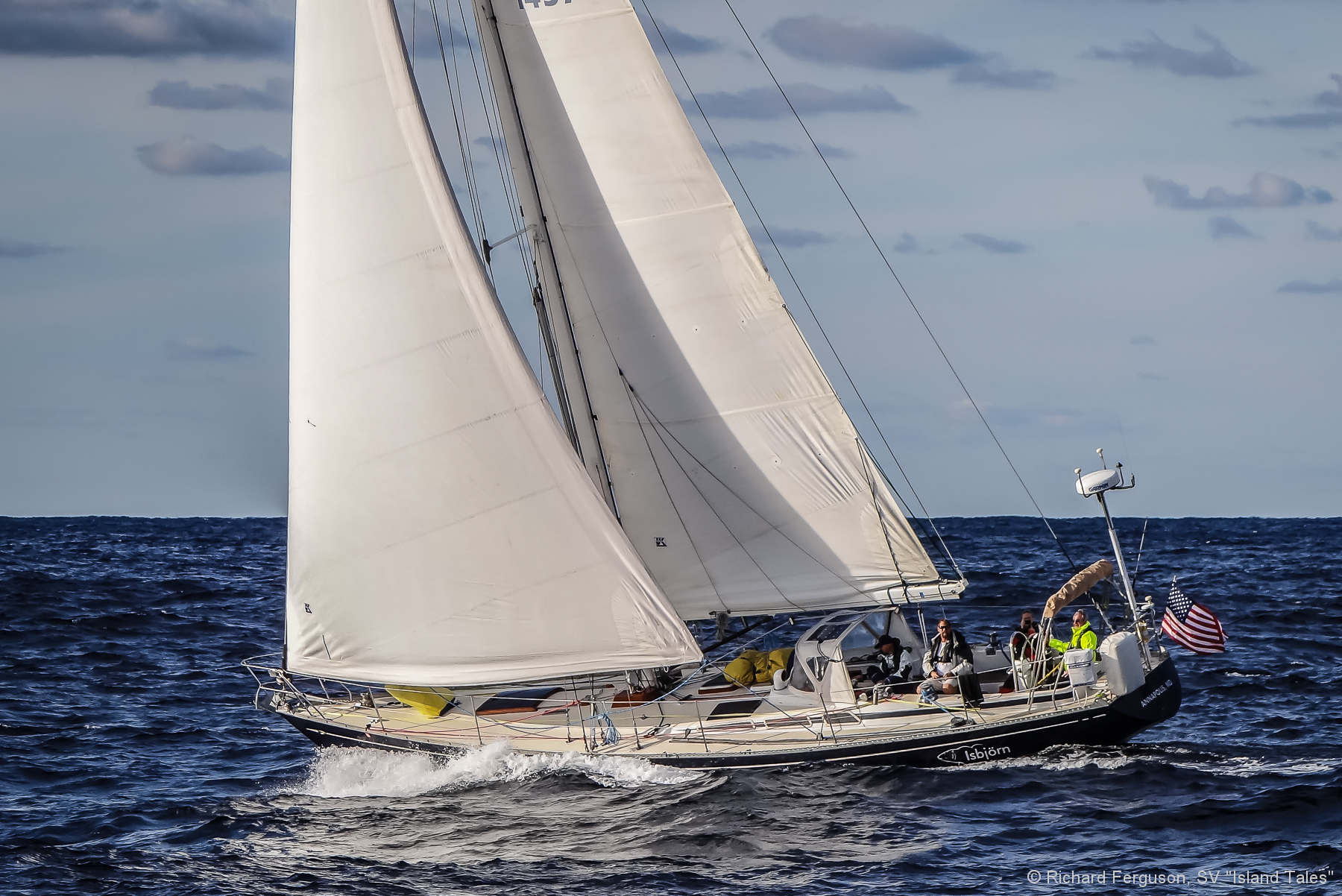
We like to sail Isbjorn, really sail her, and we’d rather contend with heavier weather (to an extent) than have to motor through a calm. I plan our departure dates with this in mind, and likewise make course adjustments en route accordingly.
Furthermore, we’ve experienced, and are prepared for, heavy weather, so we can be slightly more aggressive in our passage planning. [Andy also sails with a relatively large crew, which makes heavy weather much easier to deal with than for a couple. Ed.]
Finally, we carry the big sails too, and with Isbjorn’s extra-tall rig, can usually manage to ghost along at 4-5 knots when most others are motoring.
That said, the tools and techniques I describe below can be used just as effectively to avoid heavy weather. If you’re going offshore sailing you’ve got to be prepared mentally & physically to deal with it when the going gets rough, but you don’t have to go looking for it like the Ericsson 3 crew did.
Forecasting or Routing
There’s an important distinction between weather forecasting and weather routing. The former provides information; the latter provides information with advice. We use a professional forecasting service (details on this in Part 2), in addition to downloading free GRIB files, but I don’t employ a router per se, preferring to make course decisions on our own.
Unlike the Volvo sailors, we can’t pick our weather beyond a departure window—Isbjorn doesn’t sail fast enough to route around weather systems. But with enough information and foresight, we can avoid the worst gales, slip past the biggest calms, and generally feel much more in control of our weather destinies than at any time in yachting’s history.
Tools
Isbjorn is simply outfitted, as I outlined in detail in that third refit article. Our primary navigation tool is an iPad, receiving GPS & AIS data wirelessly via a ‘blackbox’-type Vesper XB 8000, and running the following software:
- Weather4D 2.0 (4D) (with various hydrographic office raster charts—more on this in a sec).
- iPolar to create & import your boat’s polar information into Weather 4D. [Be aware that the polars produced by iPolar are are a very crude approximations of the boat’s true performance and that relying on them without recognizing their limitations (I’m sure Andy knows this) may produce deeply flawed routing results. Eds.]
- YB Connect (our YB tracker’s app).
- XGate (for satellite email, connected to our Iridium 9555 handset via a Red Port ‘Optimizer’ wifi router).
- Vesper WatchMate app (the dedicated AIS app bundled with the XB 8000)
- Paper Charts for all primary (planned) destinations with appropriate plotting tools and redundant battery-powered GPSs. [This is an important point. Andy can safely sail with a navigation system that has many potential weaknesses and failure modes (iPad, WiFi based) only because he has the gear and skills to immediately switch to paper based navigation if required. Eds.]
- A Tamaya Sextant with up-to-date nautical almanac & HO 249 Sight Reduction Tables for Air Navigation (mostly for fun!).
- iNavX (with Navionics vector charts).
No Plotter, All iPad
The GPS on our Garmin multifunction display that came with the boat (over ten years old now) finally gave up the ghost this past summer. I didn’t bother fixing it. So while the radar still functions, the chartplotter doesn’t.
This coming winter we’ll remove the MFD and instead install a dedicated, stand-alone Furuno 1835 Radar (per AAC’s advice), and buy an iPad Pro (the larger screen version) for redundancy, which will be mounted at the nav station while the smaller iPad remains portable.
Let’s dig in to how we use all of this at sea:
Hey guys, since first writing this back in September, we’ve gone away from iNavX entirely and have switched to SeaPilot, a Swedish-designed navigation app that so far offers the best and fastest way to navigate on an iPad. The premise is that they use their own proprietary charting interface, but gather all the background chart DATUM from each countries hydrographic office. So there is a seamless transition from one global region to the next, as the interface remains the same, and it’s by far the fastest I’ve seen (It’s vector based). Currently the US charts are entirely free (yes, they’re vectorized, but the datum provided by NOAA is free, so SeaPilot kept it that way). The rest of the world’s regions usually cost less than $100 for a year subscription to access them, and they can be downloaded entirely on a wifi connection. I LOVE this software (it doesn’t YET do any weather routing, though you can overlay a basic wind barb GRIB). Stay tuned for more on this, but in the meantime, you can disregard what I wrote above about iNavX, as I no longer use it at all.
In case it wasn’t clear, we’re still using Weather 4D 2.0 as described above.
Thanks Andy, Great article, we’ve been using Predict Wind on Phantasia as we sail the Newfoundland and Labrador coast but weather 4D sounds interesting. I like the fact that its a complete charting package. Do you know if they can include the CHS Canadian Hydrographic Survey charts in their package ?
I think you and Mia are speaking at the Toronto Boat Show ? Jayne and I are too, “Sailing South Labrador” lets try get together during the show.
Best,
Mike
Hi Mike,
Yep, Mia & I will be in Toronto, let’s touch base that week. When is your seminar? Sounds interesting, I’d like to come along to it. Email me through 59-north.com.
As for the CHS charts on Weather 4D 2.0, it appears they are in fact available. Check https://geogarage.com/page/catalog for the full catalog of what is currently on offer. I’ve since found I prefer using SeaPilot to do the real navigating onboard, though having the raster charts under the WX is very helpful in visualizing the weather.
But SeaPilot, being vector-based, is MUCH faster than any raster chart I’ve used when zooming & scrolling and actually using it to navigate. https://www.seapilot.com/. I’ve been working with the SeaPilot developers about adding more ‘professional’ weather options, so hopefully that will come to fruition. But Weather 4D 2.0 remains the gold standard for the iPad.
Andy
Hi Mike and Andy,
Please take this offline. AAC comments are not the place for this kind of 1:1 chat.
I have had W4D Pro since 2014, and I was never able to figure out how to get it to provide optimized routing, even though it is supposed to. Maybe it is time to abandon W4D Pro?
With regard to quilted raster charts from official sources, so far I have very much liked the MaxSea TZ approach: the charts are straight UKHO (GB), SHOM (France), IIM (Italy), etc., but MaxSea sells them by area, not by country. So for instance if you buy Med-West, you get Med Spain, Med France, and Thyrrenian Italy, for about $50.
By way of contrast, it looks like W4D 2.0 would sell you all of Spain for about $40, all of France for about $40, and all of Spain for about $40. $120 total.
True, if you then sail to West Atlantic Europe (like we did in 2015 and will again next year), MaxSea will then sell you the region for $50, whereas with W4D 2.0 you would already own both Atlantic France and Spain, so things would sort of even out. But most people don’t sail this way.
Another difference is that with MaxSea TZ your charts are yours to keep, and you can re-download them to a new iPad purchased years afterward, whereas W4D 2.0 deletes them after 365 days, unless you re-purchase.
Andy’s comment about the speed of his raster charts on W4D 2.0 vs. SeaPilot raises my alarm bells. I can report that raster charts on MaxSea TZ pan and scan and zoom in and out on iPad just as quickly as Navionics vector charts on iPad. No penalty _at all_ for using raster charts on MaxSea TZ.
Having said this, W4D 2.0 does offer, for instance, otherwise difficult to purchase, digital official Danish Geodata Agency raster charts. These are not available on MaxSea TZ. As we’ll be in Denmark less than one year, W4D 2.0 looks to be the Danish raster chart ticket for us.
Hi Francisco,
I’ve never tried TZ on an iPad, interesting what you say about lag with the raster charts. The leg on W4D2.0 is very minimal, but with SeaPilot it’s gone completely. That said, when we use it in reality, it’s not a problem, I was just commenting for comparision’s sake. And have that quick toggle for the WX info overlay is well worth it. I think you should upgrade to 2.0. Are you sure about the charts being deleted? As I understood it, they’d remain on your iPad, they just wouldn’t be updated if the subscription expires…?
Andy
Hi Andy, Francis Fustier’s site says the Weather 4D 2.0 charts will be deleted after 365 days unless one re-purchases:
«The charts are dated and encrypted, they will be deleted at the end of one year from date to date. However, subscribed publishers renewal will be by tacit agreement, after repeated announcements by email, unless explicit refusal of the subscriber before deadline. This ensures that, in absence of the subscriber response, the charts never be deleted during a crossing. Come ashore, if the user finds an undesired publisher renewal, it will be refunded on simple request to Geogarage.»
I downloaded the W4D 2.0 manual and using it as basis I was able to get W4D Pro to optimize a route for me. Very, very cool. But we’ll probably stick with PredictWind as our main, because of its departure planning module and the fact when you do pick a departure time, it then runs 4 alternative optimized routes at the same time, with its 4 weather models. With W4D, we’d need to make several discrete optimization runs, one under each of the available weather models.
Other observations:
* We recently got an iPad Pro 12.9. It is a superior vehicle for charting and planning, because of the increased real estate. Also, on an iPad Air 2 the W4D Pro route optimization takes several seconds and you can see its progress. On the Pro, it is instantaneous.
* Whereas John’s advice re: Furuno 1835 is valid for traditional boats with fixed monitors, people gone iPad-only may consider a Furuno DSRW for $995. This is a wireless radar that connects to your iPad. It requires a $50 module on your MaxSea TZ app, but it shows you sensor data (depth, speed, etc.), AIS, and radar. And all you need to run is a very thin power cable up the mast. Power consumption at 2A is about half of the 1835.
https://www.thegpsstore.com/Furuno-DRS4W-1st-Watch-Wireless-19-4kW-Digital-Radar-P4256.aspx
Cheers,
Hi Fransisco,
I have to disagree with you on the the Furuno WiFi radar. To me radar is a mission critical device and using one that’s dependant on WiFi and a vulnerable consumer device (iPad) is really not a good idea.
Imagine being in thick fog with lots of traffic around and having any one of the many problems this combination could spawn. Not good. Even a few moments of down time could be fatal.
To be blunt, my thinking is that the Furuno WiFi radio is more a toy than a real navigation tool.
On the other hand the 1835 is a full on piece of properly mounted commercial gear—-it’s predecessors has served us for 35 years without one single failure (I have owned three units).
In summary, there are times where saving money is no savings at all, and this is one of them.
Sorry to be so harsh, but this is something I feel very strongly about.
Hi Francisco,
I have seen the wifi radar, but similarly to how John states below, we’re going with the two independent setups to make the whole system more robust. It’s exactly why we’re not going with the NXT Doppler/Hi-def radar too – that requires an MFD display, and I don’t need, nor do I WANT any of those extra features on what amounts to a crappy touch-screen display (as opposed to an iPad, which I can also use for other stuff, AND it can be waterproofed in a LifeProof case). I want radar, on it’s own screen. If the iPad nav setup fails, I’ve got paper & battery-powered GPS backup.
Plus, I’m on a bit of a different budget than the average cruiser since we run the boat as a business – it still costs money, obviously, but it’s easier to justify. And, we want to set an example on our boat of ‘best practices’ – a lot of our crew go on to buy their own boats and sail offshore, and we like to have a setup that shows how we think it’s best to do it.
Andy
Also, agree with you on the iPad Pro 12.9 – we just bought one as well and it’s great. The plan is to mount the bigger iPad Pro 12.9 at the nav station as the belowdecks nav setup. We have a second iPad Pro 9.7-inch that is ‘portable’ and can be brought on deck. All the software I mention allows installation on at least two devices (if not more), so we’re not paying any extra for that redundancy.
Note we do NOT have an onboard computer/laptop. The fact that the iPad’s can be waterproofed was the kicker for me, and that it can be mounted on the bulkhead of the nav station with a small piece of velcro, and won’t take up any desktop real estate. My laptop goes in a Pelican case when we’re offshore and doesn’t come out again while the boat is at sea.
Andy
Hi Andy,
I agree that the ability to put an iPad in a waterproof case is a big benefit and an advantage over a laptop.
In fact I recommend iPads as navigational backups for just this reason (among others).
That said, we also need to be realistic: At least as far as I know, there is no way to connect an iPad to power without breaching the waterproof case and given that navigation programs are quite power hungry I’m going to guess that your ipad at the nav station will remain plugged in most of the time, and therefore not waterproof and still vulnerable to a wave drenching the chart table, albeit less so than a laptop.
I know this sounds as if I’m looking for any reason to crap on the iPad, but really that’s not the case. Rather my concern is that we don’t let our love of the device—yes, I have an iPad pro and dote on the thing too—blind us to it’s very real vulnerabilities.
I’m not so sure that the charging issue is the issue anymore John. Check out these cases and charging cables:
https://www.itabnav.com/
Very nice case and charge setup, definitely solves the power issue. A quality wire gland for the power wire and its no different than a RAM type mounted plotter or handheld GPS. I saw another one recently as well but I can’t for the life of me remember where I saw it (go figure).
That said, I still think it shouldn’t be your absolute primary device for navigation. Which I think you agree with and I think Andy get by with since he has multiple devices and skills in paper/celestial navigation.
Ronnie
Hi Ronnie,
That looks like a really nice case, thanks.
And yes, like you I’m not a fan of the iPad as a primary navigation device.
Probably that the next generation iPad will include as for the latest iPhone wireless charging. Another plus for the iPad.
Andy, thanks for the great article. I am not familiar with W4D… yet. After reading this I will need to know more, particularly due to its double function of weather and nav. I am curently using Predict Wind in preparation to go offshore.
Is this an entire iOS suite or are they all available in Android as well?
Looking forward to part 2 and your presentation in Toronto.
Hey Marcelo,
Looks like they do have an Android version:
https://www.weather4d.com/en/weather4d-android/
Though I’m not familiar with it.
Andy
Android. Erosion is based on older version Weather4D, not the 2.0 version.
Does not include mav and maps. But still a great GRIB viewer and routing tool.
Andy,
Great article. We have the identical navigational set up as you, all the way down to the stand alone 1835. It has performed flawlessly both offshore and coastal for years. Excited to explore the WD4 in more detail after your recommendation.
Additionally, we have been using iPad navigation exclusively since its inception and don’t consider it “ a system with may weakness and failure modes” ( not your words). To the contrary we have never had an iPad crash or freeze and next to the XB 8000 these are the two most reliable systems on the entire boat short of the sails. With all due respect, the flexibility and reliability is considerable for anyone interested in a tested system.
Thanks again,
Steve
Hi Steve,
Just because you have not had an iPad navigation failure, that does not mean that iPads don’t have weaknesses, it probably just means that you are skilled at working around those weaknesses. See this post for a discussion of those intrinsic weaknesses: https://www.morganscloud.com/2017/01/22/10-tips-for-safe-navigation-with-phones-and-tablets/
Good points both John & Steve. Steve, I’ll second your notion above – I’ve not once had a problem with our iPad/Vesper XB800 setup either. But, perhaps I’m avoiding the pitfalls as John suggests. One problem with these devices in an offline environment is that they’re too smart for their own good. So you’ve got to ‘dumb’ them down, update them when ashore, etc. But it’s all pretty easy stuff if you’re paying attention.
Hi Steve,
No iPad navigation failures at all here, either.
We do run an all B&G traditional hardware system, including all sensors, radar, AIS, two B&G chart plotters, etc.
B&G lets you import a GRIB into the plotter and overlay it on the chart, but frankly, it is easier and faster to plan a route and to navigate it on the iPad. Everything seems to be easier and faster on iPad than on B&G.
Cheerio,
Francisco,
I do have an all B&G system, too, and quite satisfied except for the fact that I can not get weather overlays onto the MFD easily. That is why I will be looking into the latest Weather 4D 2.0 app.
Do you send NMEA nav real time sensor data to the iPad? If yes, how? Through a B&G WIFI1 Module plus additional gateway module?
Best,
Klaus
Hi Andy,
If your paying attention…totally.
Hi Andy and John,
I was wondering if you could expand a little on what you would recommend to do to keep an iPad working at its best when offline, besides updating them as often as possible when onshore. What do you mean by dumb them down?
Thanks
andrea
Hi Andrea,
We have an entire chapter on the dangers of using an iPad for navigation and how to manage that: https://www.morganscloud.com/2017/01/22/10-tips-for-safe-navigation-with-phones-and-tablets/
This comment may be a little off topic but I’m not sure where else to post it. It is prompted by John’s assertion that a radar is a “mission critical” piece of equipment. A search on AAC’s site for “mission critical” yields 3 pages of instances in which gear is described that way.
I think most of us would agree that a water tight hull and deck, a rudder and keel (for a monohull) and a rig are critical components for a sail boat. And no one would deny that charts, in some form or other, are decidedly useful.
But to claim that a radar or even an engine (on a sail boat) are critical is, I think, false. Very useful perhaps and possibly critical to the “mission” as defined by the vessel’s captain but not, surely, truly critical.
I bring this up with people relatively new to sailing in mind. Unlike those of us who started voyaging in the ’60’s and ’70’s (and were probably broke anyway) they face not only a bewildering choice of equipment to buy but also enormous moral pressure to do so. The West Marine Advisers are a classic example. They are informative, well written and eminently sensible but any boat under 100 tons that followed all that advice would be so overloaded as to be a menace to its crew!
So, while one skipper may consider a piece of equipment “mission critical” to him, his vessel, his intended voyage and his way of sailing it does not mean that this necessarily applies another.
Here’s one example: in1976, aged 21 I left the UK in a 24 foot cutter that I had finished from a bare hull and deck. The boat had no engine, no electricity of any sort, no through hulls, no nav lights (I know, I know, but I was 21 and in a 24 foot boat did not think I was likely to do too much damage to anyone else), no guard rails, no electronics, no radios of any sort, no towing or other log, no built in water tanks and no life raft. What I did have was a mainsail, a spinnaker, 3 headsails and 2 staysails, a sextant, an Omega watch, and a bunch of (only slightly) out of date charts. I had also been handling sail boats between 9 and 36 feet since I was 7 years old. After six years of single handed sailing and a boat load of friends and experiences that have informed my life ever since I sold the boat in New Caledonia.
Was I foolhardy? Most people nowadays might say yes, and certainly the boat my wife and I sail now does have many of those things that I did without –and did not exist — before. But did I feel less safe compared with my fellow cruisers in those days? Absolutely not (tho’ I admit that might have been because of my age. Everyone knows kids are crazy) and nor did I loose my rudder, rig or boat. I did, however, have to sail differently from those who had, for example, engines. There were a few anchorages that I could not get into and a few passages that I felt it unwise to attempt but overall I did just fine on a boat that I felt was equipped with all the “mission critical” equipment needed.
So this is an appeal to use, and to understand, the term “mission critical” with care and to remember that without defining the “mission” we cannot decide what is, and is not, “critical”.
Hi Rupert,
I agree, however I clearly defined the mission and why radar is mission critical for my mission in the link in the chapter, probably I should have linked to it again. Here it is: https://www.morganscloud.com/2016/01/28/marine-electronics-recommendations-radar/
Also note that in my comment I said “To me radar is a mission critical device”.
I’m also on record as saying that many cruisers don’t need radar.
I would also say better to have no radar than a toy radar that even Furuno classifies as recreational only, not for commercial use.
Hi Rupert,
I hear you, and second everything you’ve said. I think it’s vastly more important to understand the fundamentals first. I never used radar before this past year, mainly because I was never trained in it and not familiar with it. Since we’ve set our sights on the high latitudes, we’ve considered it more important and will refit it this winter as I wrote.
I crossed the Atlantic twice before with no radar, including via Newfoundland on our first trip in 2011 in Arcturus, a very minimally equipped 35-foot yawl which I wrote about here on AAC:
https://www.google.com/url?q=https://www.morganscloud.com/2016/04/27/refit1-a-trans-atlantic-boat-for-less-than-us100000/&sa=U&ved=0ahUKEwib39PTht3XAhWiC5oKHRTQDfwQFggLMAI&client=internal-uds-cse&cx=011492909488923319915:p-1ttyt5fbm&usg=AOvVaw1KYNY2GbNP0xuZIq0wvJZ0
To bring it back around, understanding the mission in the first place is key to outfitting a boat on any level.
Andy
Having only purchased a small plotter and depth sounder earlier this year, I have to agree with the point that one sails differently in their absence. The habits of mind and the caution engendered by older techniques and (one hopes) closer observation of the environment as opposed to a screen’s representation of the environment make one more prudent, I think, meaning that the electronics gear are not the arbiters of one’s onboard actions, but merely just another data point or points to contribute to a mental picture of what is really going on, or what the sea will present in the near future. That said, I’m getting a radar this winter and my AIS transponder arrives tomorrow!
Very cool Andy! Great write-up and I can’t wait for the next one! I’ll have to get W4d on our iPad in conjunction with our on board nav system.
Ronnie
Concerning Weather4D 2.0 as a chart plotter, there was a very good development in early summer this year.
Before, the coverage in the Mediterranean, specially in Spain and along the African Coast was very sketchy. But since June or so, the french SHOM subscription also includes all foreign maps they offer, not only France.
The costs for the subscription depends where you sail. If you cruise mostly in a area covered by one provider, the costs are slightly above but comparable to Navionics per year. If you need the German BSH maps for the Baltic, the Danish DGA maps, for some fjord-hopping Norwegian NHS maps, and to round up some UKHO for the Orkneys, things get expensive for that year.
For me, after the expansion of the French SHOMS maps to cover the Med quite well, the program became the tool of choice for me, even if it’s just a nice combined chart-plotter, AIS display and Grib-viewer. For the routing I would need to create a somewhat correct polar chart for my 35 year old lady, which is beyond my current skills.
The Navionics app kicked itself out of the running because it can’t handle NMEA over WIFI.
Thanks for the link to Weather4d, looking forward to trying it out. I use an iPad (with cellular option so it has built in gps just in case) in a Lifeproof case, fully independent radar system, independent AIS, a couple handheld gps’s as backup, and paper charts. I don’t use the onboard nav pc anymore even though it’s still there at the nav table. Personally I’ve had more failures and headaches from the PC and NMEA hardware than I have from the iPad but I think they’re both equally prone to failure being computers. However, the iPad can continue to navigate via internal gps when the nmea system goes on strike so it feels a little more robust to me than the PC for the most common failure mode (at least on my boat).
Andy,
I think you forgot to mention one of the best feature of Weather4D 2.0 that no other GRIB viewer include: The ability to display what the author call a meteogram for any of the GRIB data. This meteogram gives you an instantaneous graphic visual of what the wind/pressure (or other data) will be over time at a specific location or along a route. So nice for planning a departure time, or along the route to anticipate the weather.
Also, when you do not have a GO, how do you connect the iPad with the sat phone ? What is the gateway you are using ?
Hi Andy,
I was wondering, with your current setup you don’t have the ability to overlay radar on your plotter , correct?
Di you know of any radar that can be overlayed on iPad navigation apps?
Thanks!
We used this one on our way over the Atlantic from west, and east. gives you routing and you can put in your polarogram, and adjust it down in preformans.
easy to use, and you can use it from the satphone as well.
https://www.fastseas.com
made by sailor, for sailors.
have a look.
Hi Geir ove,
That does look interesting, I will have to have a play around with it.
Andy and all,
It looks like the app has moved into a few different apps in the App Store. The most expensive at $50 is the navigation and routing app. After that purchase you have to subscribe to your charting. The USA noaa charts are now €3.49/year and not free. Which is a bummer because now I have an rather expensive app to view free charts on a fee subscription.
Just thought I would update everyone who may be looking at this app.
Ronnie
Hi Ronnie,
In view of the huge amount of coding that an app like this represents, coupled with the very small potential market relative to general use apps, I would not view that as expensive, particularly when compared to computer based apps like Maxsea. Also, the support load of publishing an App like this is huge so I don’t view a relatively small ongoing charge, even for charts that are provided free by the US government, as unreasonable either.
I guess that as a content provider I sympathize with others trying to make ends meet in this market.
John,
I didn’t mind the app price,it was just the sub for the free noaa charts. I don’t mind paying for a great service (including this goldmine of sailing information).
I did however searched for other routing software and you are correct this is a fraction of the others. I believe maxsea was more than a boat buck for the routing package.
Best regards,
Ronnie