Online Book: Weather Reception and Analysis
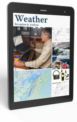
Step-by-step methods to analyze weather information while offshore and in remote places for safer and more comfortable voyages.
Click for TOC or scroll down for details
-
Why We Wrote This Book
3 CommentsReading Time: 3 minutesFreeRead more: Why We Wrote This BookFREE introductory chapter. So why should you learn how to receive and interpret weather information? Surely all we need to do is employ a weather router and/or use one of the cool weather forecast tools available, perhaps including routing software? All good stuff, but we also need basic understanding. Here’s why.
-
Weather Analysis—Hardware and Software
42 CommentsReading Time: 11 minutesMembersRead more: Weather Analysis—Hardware and SoftwareWhich hardware and software should we use for weather downloading and analysis? Lots of good stuff out there. Here’s how to choose.
-
Weather Analysis—Part 1, Tactical
44 CommentsReading Time: 12 minutesMembersRead more: Weather Analysis—Part 1, TacticalMost discussions about weather reception and analysis in the cruising community end up focused on the tools and technology. But that’s not what matters. In fact, planning fun and safe cruises is all about how we USE the tools and THINK about weather. That’s just what this chapter, based on some 25 years of real cruising experience, is about.
-
Weather Analysis—Part 2, Strategic
9 CommentsReading Time: 10 minutesMembersRead more: Weather Analysis—Part 2, StrategicWith modern weather reception and analysis tools we can plan our cruises and voyages as much as two weeks ahead. John shares how.
-
It’s A Forecast, Not A Prophecy
2 CommentsReading Time: 4 minutesMembersRead more: It’s A Forecast, Not A ProphecyIn the last chapter I wrote about the importance of understanding the weather systems in a wide area around you rather than just looking at a GRIB or forecast for your immediate area. I believe this is so important that I’m going to write about another storm to drive the point home.
-
Managing Ocean Currents
20 CommentsReading Time: 4 minutesMembersRead more: Managing Ocean CurrentsI have written a lot about weather up to this point in the book, but in many cases routing for the combination of the prevailing weather and any current or tide can be the most important contributor to a comfortable and safe passage. In this chapter I look at a real Gulfstream passage and discuss what to look for.
-
9 Tips to Assess Weather Forecast Accuracy
21 CommentsReading Time: 11 minutesMembersRead more: 9 Tips to Assess Weather Forecast AccuracyIt’s comforting to believe that weather forecasts are always right, but we all know that’s not true. Here’s how to assess the chances that a given forecast will be wrong in a bad way.

