
[In his last post, Andy detailed his preferred weather reception and voyage routing software running on an iPad. In this chapter he shares how he used his understanding of the weather and strategic route planning (together with the high-tech tools) during his recent Atlantic crossing, to make a faster and better passage than just sticking with the normal route would have. Eds.]
In May 2017, we set out from Bermuda in Isbjorn, our Swan 48, with the ARC Europe rally, bound across the Atlantic for Horta in the Azores. The Azores High is the dominant feature that time of year in that neck of the woods, and properly routing around it can give pleasant downwind sailing, but routing right through it (the rhumb line from Bermuda), often gives days of calms.
The forecast before departure showed a typical pattern, with the high stable and the lows predicted to travel around and across the top. But the high was centred slightly further south than usual, so the standard route—sailing NNE up to 40ºN, then turning east and sailing across the top of the high, before diving back south to 38º30’N, the latitude of Horta—seemed unnecessary.
Motor to The Wind
Instead, we set course NNE for 37º or 38ºN, keeping an eye on a big low forecast to approach from the west a few days after departure. We motored for the first 15 hours to get to the westerlies at the top of the high. Once they filled in, we didn’t run the engine again until we motored onto the dock in Horta, 12 days later.
Hi Andy,
Sounds like a fine passage well executed.
I am always interested in how others handle downwind sail configuration and I notice that you doused headsails downwind and went with a well reefed main. Although I am loath to get rid of all the mainsail, I am more inclined to make the headsail (or staysail) last sail up. Perhaps this is a characteristic of a true cutter (mast almost amidships), but I find that the main alone is harder on the helmsman (autopilot) than a headsail alone which tends to draw the boat along and demand less action from the helm.
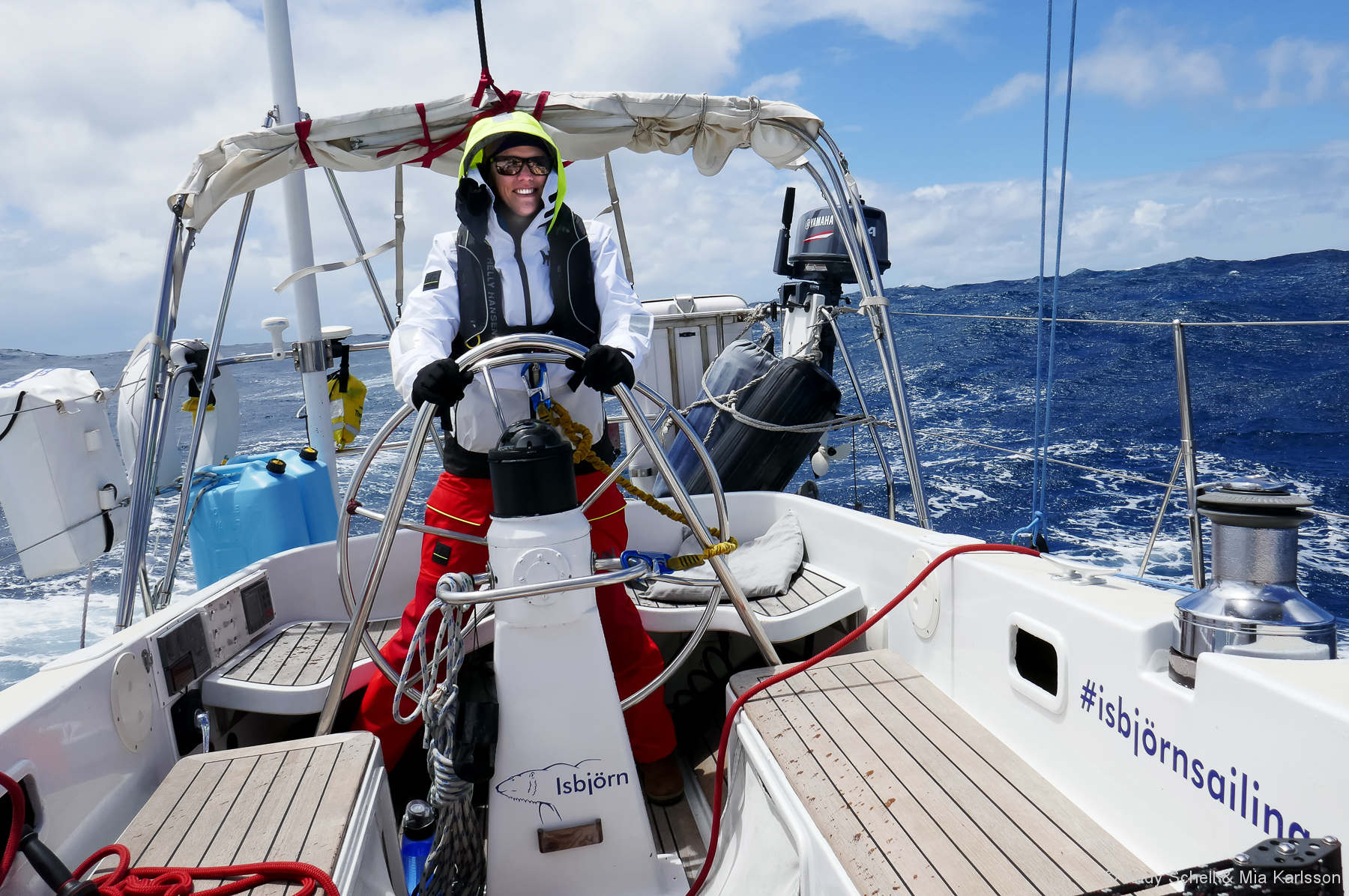
Lastly, I think I am impressed that anyone would go aloft at sea for fun, but for those who are looking over your shoulder for pointers and may need to go up their mast at sea, I would very much wish them in shoes and wearing a climbing helmet.
My best, Dick Stevenson, s/v Alchemy
Hi Dick,
Thanks for the comments! Yes, shoes & helmet definitely highly recommended on my end too. It was FLAT calm in that photo, and the boat stabilized with the sails up, but still, probably a tad foolish on my part, if I was advising myself 😉
As for sail configuration, I agree with you. In this case it came down to ease of use – in the lulls we rolled out some genoa, in the puffs we rolled it in, which was much easier off the wind than lowering the main completely. Our third reef is VERY deep, so we hardly had any sail up at all. The boat kind of just mosy-ed along under triple-reefed main quite nicely to my surprise actually, and the autopilot steered fine, with hardly any pressure on the helm. We weren’t in seriously gnarly conditions at that point either. Don’t know what else to say – I think I’d have said the same thing as you as a commenter, regarding preferring headsail over mainsail off the wind, but in practice it worked much better than I’d have expected, so we kept it.
Andy
I apologize for mostly likely being in the wrong forum. My issue is not so much weather routing as “current” routing. My whole boating life has revolved much more around the Gulf Stream and it’s eddies as I sail out of Lake Worth Inlet, Fl.
I’ve read the weather 4.0 book and can generate a weather route and a current route but not the two together. I know I’m missing something, but the video illustration in weather 4.0 for a route to New Providence shows the vessel going in a near straight line to the Bahamas from our inlet at 7 knots with minor adjustments for wind. I would end up in West End on that tack. What am I missing here? I really like the program otherwise but it’s useless here w/o the current factored in.. Thanks Jim Harris
Hi Jim,
Andy most likely won’t answer, see #3 https://www.morganscloud.com/2013/11/10/aac-comment-guide-lines/
And I have never used that app, so no help there. I’m guessing that Weather 4 is assuming that you will crank in the course adjustment to account for the GS yourself when you set out.
A crude way to do this is to just steer the right course to produce no cross-track error to the waypoint according to the GPS when you get out there—what most people do these days.
But this is slow and inefficient. Better, and way more professional, to do it right with a vector diagram using average current. This way, when the current is less, either side of the GS core, you will make southing, and in the core get swept a bit north of the rum line. If you get it perfect you will steer the same heading all the way across but The result is an S shaped course across the bottom, and more efficient.
Maybe Weather 4 can calculate that heading for you independent of it’s weather function or even together with it, but if not there are any number of navigation books that explain how to do this by constructing a current vector diagram. Even if weather 4 can do it, it’s well worth understanding the theory of what it’s doing.
Hi Andy and Dick,
I know that it would seem logical to assume that a headsail would yield easier steering in these conditions, but in reality my experience has been the same as Andy’s: a triple reefed main works great, to the point that it has been our heavy weather down wind standard for 20 years.
And the main has many flexibility and safety advantages, the most notable being that with a triple reefed main up and a staysail on a furler, as we have, heaving-to is easy and quick.
More here: https://www.morganscloud.com/2014/11/17/your-mainsail-is-your-friend/
Glad to hear that John. You don’t often read about mainsail-only in this scenario – we kind of figured it out in real-time, rather than acting on any kind of theory. It seemed easiest at the time, worked well, and we’ve since adopted it.
Another scenario that worked really well for us en route from the Chesapeake to BVI last fall, similar to your roller-staysail setup: we have a hank-on staysail, roller-genoa. In close-reaching, very squally (pre-frontal) condition on the far side of the Gulf Stream, we had 3 reefs in the mainsail, full staysail (hoisted on hanks), and half the roller-genoa. When a squall beared down on us, we simply rolled the entire genoa and went 3-reefed main plus hanked-on staysail. In the lulls, half the genoa was rolled out again. Super fast, kept the boat driving forward in the lulls, but easily allowed us to downshift in the squalls.
Wow. What an intelligent analysis of the wx on that passage. I was doing a solo passage from NW Spain to Horta at exactly the same time (in other words, from the other direction). I am much more of an intermediate level sailor, so made lots of mistakes, so your strategy of dealing with the gale was quite interesting. I too remained North and tried to sprint as far West as I could before turning South into Horta (using Predict Wind). It worked perfectly for 850 of the 950 NM trip. I just couldn’t get far enough West to do a broad reach into Horta, and ended up taking the gale on the nose. This video summarizes my final 30 hours that were a bit difficult for me. (I know, lots mistakes, but I learned enormously from this and feel much better prepared for another challenge in 2018.) Thanks for a great article. https://www.youtube.com/watch?v=kUTEYa1yvfg
Glad you liked it Patrick. I’ll have a look at your video.
-Andy
Andy,
Thanks for the article.
Harking back to John’s post on running rigging I was interested to see in your photo running “east under triple reefed main” that you use low friction eyes at your reef cringles.
With increasing age I have noticed that pulling in reefs has become harder and have been looking around for ways to decrease friction at the cringle. At one point Plastimo made a pressed eye with a small sheave in it but I have been unable to track it down. Antal, and no doubt others, make cheek blocks that can be webbed to the sail’s leech but I’m attracted to your solution. Can you tell us more about it?
Hi Rupert,
Good eye 😉 Those Antal low-friction rings are one of my favorite parts of that mainsail, which we had built specifically for the type of cruising we do by my good friends at Chesapeake Sailmakers in Annapolis – ie: lots of offshore miles, with a bit of performance. The sail itself is of Hydranet cloth, tri-radial construction, with three deep reefs. There are a couple of offshore-specific features:
-Battens slide in from the front, through the battcars that have a removeable cover. Batten tensioner built into the battcar. So gives a solid leech – the battens can’t pop out the back.
-Low-friction, external reef cringles. Again, no holes in the leech of the sail, a high-load area. Instead, there’s webbing at each reef cringle, and the low-friction ring is simply lashed to that webbing, which in-turn is much more easily repairable/replaceable than a press-ring, even in the field with hand tools.
-Reef lines lead aft into the end of the boom and forward through the inside of the boom, then aft down the deck and under the dodger. The reef lines should ideally not go all the way to the end of the boom, but only aft slight and inside the boom. Brion Toss has a lot to say about this. Leading them all the way aft into the back end of the boom is easier, but not ideal on the load on the line, which ideally should be equally ‘down’ and ‘aft,’ to get the reef point to set correctly, if that makes sense. A cheek-block on the boom and external reef lines would accomplish the same thing more easily.
We hope to get 50,000 miles out of that sail (it already has over 15,000, and is good as new).
Hope that all makes sense.
-Andy
Thanks, Andy, it does. Love the low-friction ring alternative to pressed rings.
Andy, as a curiosity, what is your average Iridium com budget for retrieving GRIB data while offshore ? For a passage like Bermuda to Azores about 13 days, did you retrieved GRIB daily? What area size / GRIB file size around the boat location ? Sharing those details will help us define a strategy. Thanks
Hi Phil,
We spend $750/year on sat minutes through http://www.ocens.com, plus maybe $50 for the Xgate email subscription. That gets us 500 minutes which last for a year, and is way more than we ever use (unfortunately they expire if you don’t use them).
The GRIB downloads take only a minute or two, and the file sizes are around 50kb. Offshore I reduce the resolution to 2º lat/long, and only receive a 3-4 day forecast outlook. Daily in an unstable weather pattern, sometimes only every 3rd or 4th day if it’s a stable pattern (in the Trades, for example).
Those minutes are also used for sending text-only emails, which 99% of the time are just blogs that I write every 2nd or 3rd day and send in to our website. I had a conversation recently with the owner of a much bigger cruising boat who spends over $1,000/MONTH on sat comms, which is fine for them, but absolutely unnecessary. I have considered getting an Iridium GO!, but frankly I enjoy not spending so much time/effort on digital stuff offshore. The handset works fine as-is for downloading with the little Optimizer wifi router, and if I feel the need to speak to someone about the weather or whatever, I pick up the sat phone and make a call. You’d be hard-pressed to find a simpler, cheaper solution to sat comms than what we use on Isbjorn, and I like it like that.
The only thing I wish we had (and we might add this winter) is a fixed, external sat antenna, which would make setting up the whole thing much easier.
Andy
Thanks, much appreciated.
Hi Phil,
We have a chapter on just that here: https://www.morganscloud.com/2011/11/17/weather-system-gribs/
Yes, I have read that article too. But Andy’s real $ number is priceless!