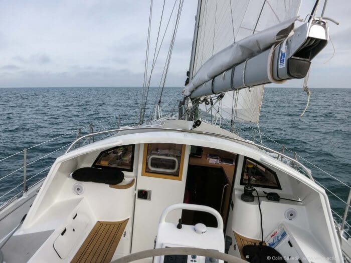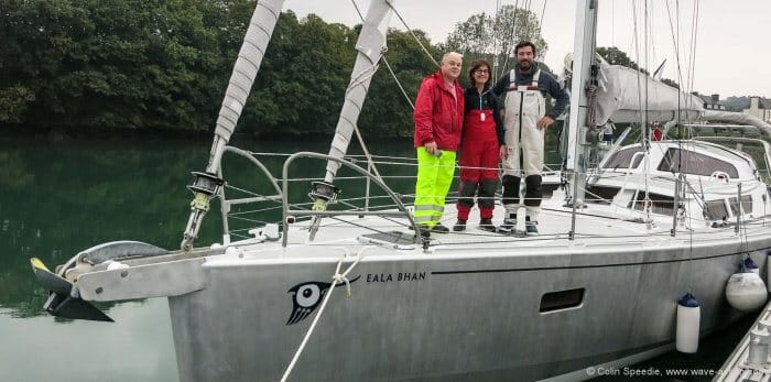
After her successful display at the La Rochelle Boat Show in September, Eala Bhan, the first Boréal 55, had been returned to Tréguier, Brittany, where she was built, for final adjustment and refinement prior to her ‘proper’ maiden voyage home to the west of Scotland.
Apart from a couple of short sails, Patrick and Linda, the owners, had not had the chance to use her since her launch in June, when I had joined them for a day’s outing. As a result she remained, to all intents and purposes, a totally new boat to us all.
As I was the first to arrive at the port, I set about making lists of things to buy and checking anything and everything in readiness for our departure. The first few weeks in the life of a new boat are critical in terms of settling everything down, and carelessness at this stage can often result in totally avoidable damage; to mechanical systems and sails, for example.
This is not the time to put the pedal to the metal—it’s much better to not push the boat too hard and monitor everything religiously. That way the inevitable little glitches that appear can be nipped in the bud before they become major issues, and you can get to know all of the systems and how they work.
I’m a great notetaker during this phase when I’m monitoring new gear, which enables easy assessment that there are no sudden changes in parameters that could give advance warning of a developing problem—this is time well spent, trust me.

Once we were all together, the pace picked up considerably with three sets of hands available, and between us we steadily emptied the combined chandleries of Tréguier of the basics such as fuel filters, impellers and alternator belts, and built up the tool kit.
Finally, with enough food, fuel and water aboard to see us across the Atlantic, we settled down to plan our voyage home.

Hi Colin,
Great read! It would be terrific if all maritime authors wedged in as much excellent piloting information as you are able to accomplish.
My best, Dick Stevenson, s/v Alchemy
Hi Dick
Thanks for the comment – one day maybe I’ll write some form of sailing directions for that run. After all, I know it backwards!
Best wishes
Colin
A really nice write up, and an especially important point regarding having the ability on board to cross check light characteristics, especially if you don’t or are unable to update either your electronic or paper charts in a timely manner.
Hi Tristan
I agree with you about always having the ability to cross-reference. This isn’t the first time I’ve seen incorrect or out of date information in electronic formats. It amazes me that people trust electronics unconditionally. Up to date paper based information seldom fails, by comparison!
Glad you liked the article,
Colin
Colin,
concerning our trust in electronic data, there isn’t much to be amazed by it.
On one hand we’re conditioned that electronic stuff updates itself all the time, but this ritual of black magic doesn’t give us an understanding of what has changed. We feel good by having Version 5.1.4-20160215 installed, we did our part to be up to date. Everything is fine. What the experts changed is beyond our scope, even if the vendor provides the usual endless list of cryptic changes.
On the other hand, if I drag out a paper chart dating back to 1984, I expect things not to be up to date. The risk is easier to understand even for a layman than getting the same dated information from the latest update in your chart plotter, where the vendor bought the same charts on the cheap a few years back and updating isn’t an attractive business proposition.
Hi Jo
I agree with all you say, and wish it weren’t so. John has also banged the point home on this subject regularly here at AAC. If we keep going down the route of trusting electronics completely then accidents will continue to happen.
And thank you for the interesting link.
Best wishes
Colin
Hi Jo and Colin,
Sorry, but looks like US Coast Guard deesagree with your opinion
To be clear I’m not against paper charts, and I definitlly carry them for backup and cross reference. However I think sailors who fail to use electronic chatrts will fail to use paper one in much more spectacular way. Here are few reasons why:
* Paper charts are much more expensive. For a same budget you will always have less paper charts. In the end you will not have detalied paper chart for some area on board when you need it. It is imposible with electronic charts when areas are very lardge.
* Even if money are not a problem how many detailed charts you could store on board. You will always compromise and not carry some.
* If you buy electronic charts like Navionics you in efect always have 2 charts: standard navigation charts + sonar charts. You can always cross examine them. With paper chart you have only single one.
* Still becouese of budget you probably have more then one electronic chart on board. I personally have Navionics on tablet/phone + other make on yacht ploter/laptop (I charter so it varies). Again cross checking them is crousial but is possible only with electronic charts.
* You have electronic chart always with you, wherever you are on board. It happen to me few times what I went on bow to do/fix something and suddenly I was not sure if person on a helm is stering correcly. With electronic chart you don’t need to run down below, you take your phone out of pocket, check your position and heading and know everything. Hardly takes more then 10 seconds. This works as easy in your bunk, heads or when cooking.
* Upgrading charts always require a lot of trust both if it is one of maijor chart producer who is doing it or some junior apprentice in your local chart shop – I’m afraid I will not upgrade paper charts myself becouse of time required.
I think you get my point. I wrote this becouse I think this page promotes good practice and common sense. If you will say:
* carring single make of electronic chart is irresponsible
* carring electronic chart on single divice is irresponsible
* carring electronic charts on not watter proof device (eg iPhone/iPad) is irresponsible
* not carring paper charrts as backup is irresponsible
I will argree with you.
However I got it a bit like you suggest of puting full trust only in paper charts.
I’m sorry but I feel it is irresponsible.
Best
Arek
Hi Arek,
I think you are arguing against a straw man there. Colin has never said that electronic charts don’t have a place. In fact he is a long term user of electronic charts. All he pointed out was that trusting electronics blindly is not a good idea.
Also, never forget that most electronic charts are derived from raster files of paper charts, but have to go through a conversion process to vector, which is error prone.
You may wish to read our Navigation online book for a better understanding of our position on paper and electronic charts: https://www.morganscloud.com/category/navigation/book-navigation-electronics/
Hi Colin,
Your article is very timely as we are planning more or less the same route starting in early May from Cherbourg on our Garcia Exploration 45. I have peered through quite a few publications, including Imray guides but I find the pilotage advice in your article a lot crisper. On that matter could you recommend a publication covering sailing directions for the Irish Sea, Scotland and Western Ireland. Also can you share with me what is your favoured entry point into the Isles of Scilly in a North bound direction. Many thanks.
Chris
Hi Chris
I’d guess you have the Imray Irish Sea Pilot which is good, and the Irish Cruising Club guide to the East and North coasts of Ireland. Bear in mind that in strong easterlies it’s much better to go up the coast of Wales so make sure you have coverage for the eastern shores of the Irish Sea.
Or, of course, go around the west coast of Ireland, where the ICC pilot for the south and west coasts is excellent. It’s also good to carry their Cruising guide for Ireland which has a wealth of wonderful knowledge to help you get the most out of sailing around Ireland.
In Scotland, Martin Lawrence’s Imray guides are hard to beat, although I’ve always carried the Clyde Cruising Club pilots as well. For the sheer pleasure of the islands, I carry Hamish Haswell-Smith’s Scottish Islands is a must. And if you want to do some creek crawling, maybe check out the Antares charts (www.antares.co.uk), which I found really useful last time I was in the Islands.
For the Isles of Scilly, it’s all about the wind direction you expect during your stay. The easiest entry from the south is the Cove between St Agnes and Gugh, excellent in anything from the north, but wide open to the south and east. If you’re going into the islands, maybe enter via St Mary’s Sound, and as the tide allows move to the best anchorage to suit the prevailing wind. The only ‘all wind direction’ anchorage is at St Helen’s Pool, and it’s a lovely spot, but anywhere else and you must be prepared to move as the wind shifts, before the swell finds you. In short, it’s a wonderful place, but pick your weather!
Best wishes
Colin
Thanks Colin, looks like a season there won’t be enough!
Cheers
Chris
Hi Chris
a season up there will only whet your appetite!
Hope all goes well with the new boat, and you’ll find plenty of places where you’re going where you’ll really appreciate shoal draft.
Best wishes
Colin
Hi Colin,
Really enjoying this series – you transport me back over 30 years to many sails in the area.
On the resources, would you still use the Admiralty Sailing Directions (Pilots)? I recall one cruising pilot (Imray published I think), that gave the wrong timing by 3 hours for the tidal gate off Skomer Island. The Admiralty pilot was spot on. After that I tended to only trust the Admiralty pilots, and even more so later, as a professional navigator working around the world.
A quick check of the UK Hydrographic Office shows the: Channel pilot, the West coast of England and Wales pilot, the Irish coast pilot and NW coast of Scotland pilot all available in print. I would add to that their list of lights (updated annually). They would be my first choice for passage making, but things may have changed in that time.
In NZ we have the NZ Nautical Almanac, published annually that gives all the lights, tides sunrise/set and much more – a real go to reference.
Thanks for the memories!
Rob
Hi Rob
when I first worked on the west coast nearly twenty five years ago I had access to all of the available pilots including the Admiralty one. As I was completely new to the area I took care to check all three before going anywhere tricky.
But since then I have relied on the CCC and Imray pilots because (a) the Admiralty pilot was very ‘big ship’ stuff, (b) wasn’t updated regularly and (c) the other pilots were steadily improved and new editions issued.
Between the latest issues and the Antares charts I think today’s navigator in the western isles is spoiled!
Best wishes
Colin
looking forward to the next installments in this series…nice boat too…those hydranet sails must be quite a pleasure to fly…from one sailing writer to another, you might want to police up those indirect object pronouns to use ‘me’ vs ‘i’ when appropriate…noticed a couple lapses here…we have a fair number of word usage variations between yank and brit english that i won’t quibble over, but our grammatical usage is totally uniform…cheers…richard s. (now holed up in tampa bay for probably another six weeks before being back in the antilles for a while)
Hi Richard
The Hydranet sails are excellent, and a pleasure to look at as much as use.
Sorry about the errors – I should have paid more attention at school!
Best wishes
Colin
What a wonderful write up, graphic enough to bring it all flooding back; the joys of getting round the end of Cornwall ( one day we might get it right..), traffic lanes, decisions about which coast and more. Thank you.
ps excellent response on the Pilots for the area too and even if you’re not going to cruise the area Haswell-Smith’s book is simply wonderful to browse through.
Hi Mick
glad you liked it.
And as for rounding Lands End, it can be a real Everest when the winds are against you – took me a whole day once from The Lizard to round Cape Cornwall.
And yes, Haswell-Smith’s book is the perfect fireside armchair read in winter, awash with the wonders of the islands and beautifully illustrated – a firm favourite in our home.
Best wishes
Colin
Any chance of adding some more info on the boat’s performance?
Hi
the boat sails beautifully and is easy to handle – and you’ll find more in Part III (which will be up soon) when we really had a chance to stretch her legs in some stronger conditions. Hope you’ll come back for Part III.
Best wishes
Colin
Hi Npf 1,
You will find a bunch more information on how the Boreals sail in this series: https://www.morganscloud.com/category/boat-design-selection/boreal/boreal-44-47/